Ficheiro:Kingdoms of Israel and Judah map 830.svg
Fonte: Enciclopédia de conhecimento da Igreja de Deus
Saltar para a navegação
Saltar para a pesquisa

Dimensões desta antevisão em PNG do ficheiro SVG: 502 × 599 píxeis Outras resoluções: 201 × 240 píxeis | 402 × 480 píxeis | 644 × 768 píxeis | 858 × 1 024 píxeis | 1 717 × 2 048 píxeis | 720 × 859 píxeis.
Ficheiro original (ficheiro SVG, de 720 × 859 píxeis, tamanho: 96 kB)
Este ficheiro vem da wiki na wiki Wikimedia Commons e pode ser usado por outros projetos. A descrição na página original de descrição do ficheiro é mostrada abaixo.
| DescriçãoKingdoms of Israel and Judah map 830.svg |
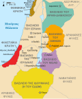
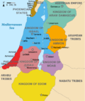
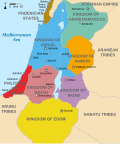
English: Approximate map showing (blue) and (orange), ancient Southern Levant borders and ancient cities such as Urmomium and Jerash. The map shows the region in the 9th century BCE. Italiano: Il regno di Giuda e quello di Israele nell'età del ferro (VIII secolo a.C.).
日本語: 紀元前830年代のユダ王国(黄色).
Русский: Царство Иудея 927 по 526 гг. до н. э. Отсюда иудеи были сосланы завоевателями в Вавилонский регион.
Bahasa Indonesia: Peta kerajaan-kerajaan di daerah tersebut pada abad 9 SM.
Simple English: The northern Kingdom of Israel and the Kingdom of Judah to the south.
Srpskohrvatski / српскохрватски: Karta Sjevernog i JUžnog Kraljevstva. Samarija je bila glavni grad Kraljevstva Izrael (plavo). 830-e pne.,.
Latviešu: Izraēlas un Jūdejas karalistes. Jūdejas karaliste (dzeltenā) ap 830. gadu p.m.ē. |
| Data | (UTC) |
| Origem | http://www.jewishvirtuallibrary.org/map-of-israel-and-judah-733-bce |
| Autor |
|
| Outras versões |
[editar]
|
Eu, titular dos direitos de autor desta obra, publico-a com as seguintes licenças:
A utilização deste ficheiro é regulada nos termos da licença Creative Commons - Atribuição-CompartilhaIgual 3.0 Não Adaptada.
- Pode:
- partilhar – copiar, distribuir e transmitir a obra
- recombinar – criar obras derivadas
- De acordo com as seguintes condições:
- atribuição – Tem de fazer a devida atribuição da autoria, fornecer uma hiperligação para a licença e indicar se foram feitas alterações. Pode fazê-lo de qualquer forma razoável, mas não de forma a sugerir que o licenciador o apoia ou subscreve o seu uso da obra.
- partilha nos termos da mesma licença – Se remisturar, transformar ou ampliar o conteúdo, tem de distribuir as suas contribuições com a mesma licença ou uma licença compatível com a original.

|
É concedida permissão para copiar, distribuir e/ou modificar este documento nos termos da Licença de Documentação Livre GNU, versão 1.2 ou qualquer versão posterior publicada pela Free Software Foundation; sem Secções Invariantes, sem textos de Capa e sem textos de Contra-Capa. É incluída uma cópia da licença na secção intitulada GNU Free Documentation License.http://www.gnu.org/copyleft/fdl.htmlGFDLGNU Free Documentation Licensetruetrue |
Pode escolher a licença que quiser.
Registo de carregamento original
This image is a derivative work of the following images:
- File:Oldtidens_Israel_&_Judea.svg licensed with Cc-by-sa-3.0, GFDL
- 2010-01-30T16:10:36Z FinnWikiNo 726x868 (109641 Bytes) {{Information |Description={{en|1=Map showing the ancient levant borders and ancient cities such as [[Urmomium]] and [[Jerash]]. The map also shows the region in the 9th century BCE. Notice the coastal land of Philistia, from
Uploaded with derivativeFX
Legendas
Adicione uma explicação de uma linha do que este ficheiro representa
Map of the Divided Kingdoms of Israel and Judah, ca. 9th Century BCE
പുരാതന യിസ്രായേൽ-യഹൂദ രാജ്യങ്ങൾ
Isroil (koʻk rangda) va Yahudo (toʻq sariq rangda) qirolliklari, qadimgi Janubiy Levant chegaralari va Urmomium va Jerash kabi qadimiy shaharlarni koʻrsatadigan taxminiy xarita. Xaritada mintaqa miloddan avvalgi 9-asrda koʻrsatilgan.
Approximate map showinhjjjg the Kingdoms of Israel (blue) and Judah (orange), ancient Southern Levant borders and ancient cities. The map shows the region in the 9th century BCE.
Elementos retratados neste ficheiro
retrata
12 julho 2010
image/svg+xml
98 801 byte
d2610d1d729075b3e138c7c5a6a2b24960d13444
Histórico do ficheiro
Clique uma data e hora para ver o ficheiro tal como ele se encontrava nessa altura.
| Data e hora | Dimensões | Utilizador | Comentário | |
|---|---|---|---|---|
| atual | 14h12min de 1 de outubro de 2021 | 720 × 859 (96 kB) | wikimediacommons>Sadopaul | File uploaded using svgtranslate tool (https://svgtranslate.toolforge.org/). Added translation for ko. |
Utilização local do ficheiro
A seguinte página usa este ficheiro:
Metadados
Este ficheiro contém informação adicional, provavelmente acrescentada pela câmara digital ou pelo digitalizador usados para criá-lo.
Caso o ficheiro tenha sido modificado a partir do seu estado original, alguns detalhes poderão não refletir completamente as mudanças efetuadas.
| Largura | 719.58716 |
|---|---|
| Altura | 858.64001 |


