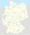
Ficheiro:Germany, Federal Republic of location map September 1955 - December 1956.svg

Ficheiro original (ficheiro SVG, de 1 075 × 1 273 píxeis, tamanho: 497 kB)
Este ficheiro vem da wiki na wiki Wikimedia Commons e pode ser usado por outros projetos. A descrição na página original de descrição do ficheiro é mostrada abaixo.
Descrição do ficheiro
| DescriçãoGermany, Federal Republic of location map September 1955 - December 1956.svg |
Deutsch: Positionskarte der Bundesrepublik Deutschland. Diese Karte zeigt die Bundesrepublik im Gebietsstand zwischen September 1955 bis Dezember 1956.
Quadratische Plattkarte, N-S-Streckung 150 %. Geographische Begrenzung der Karte:
English: Location map of Federal Republic of Germany. Map shows West-Germany as of September 1955 till December 1956.
Equirectangular projection, N/S stretching 150 %. Geographic limits of the map:
|
||
| Data | Created in 2009 | ||
| Origem | own work, based on File:Germany location map.svg | ||
| Autor | TUBS | ||
| Permissão (Reutilizar este ficheiro) |
TUBS, titular dos direitos de autor desta obra, publica-a com as seguintes licenças: A utilização deste ficheiro é regulada nos termos da licença Creative Commons - Atribuição-CompartilhaIgual 3.0 Não Adaptada. Atribuição: TUBS
Pode escolher a licença que quiser. |
||
| Outras versões |
Bundesrepublik Deutschland (vor 1990 nur West-Deutschland):
Deutsche Demokratische Republik (mit BRD im Ausschnitt):
Ostdeutschland (vor 1990 Deutsche Demokratische Republik):
Deutschland zwischen Mai 1945 und Oktober 1949:
Thematisch:
Deutsches Reich (1918–1945) (best used with this template (de)):
|
Registo de carregamento original
| date/time | username | resolution | size | edit summary |
|---|---|---|---|---|
| 2009-01-18T03:27:48Z | User:TUBS | 1075×1273 | 496.72Kb | {{Information |Description=Germany,_Federal_Republic_of__location_map_April_1952_-_August_1955 |Source=own work |Date=2009 |Author=[[Author:TUBS]] |Permission= |other_versions= }} |
Legendas
Elementos retratados neste ficheiro
retrata
Um valor sem um elemento no repositório Wikidata
Histórico do ficheiro
Clique uma data e hora para ver o ficheiro tal como ele se encontrava nessa altura.
| Data e hora | Dimensões | Utilizador | Comentário | |
|---|---|---|---|---|
| atual | 14h53min de 1 de julho de 2009 | 1 075 × 1 273 (497 kB) | wikimediacommons>BetacommandBot | move approved by: User:Enomil This image was moved from File:Germany, Federal Republic of location map September 1955 - December 1957.svg == {{int:filedesc}} == {{Information |Description= {{de|Positionskarte der [[:de:Deutschland|Bundesrepublik |
Utilização local do ficheiro
A seguinte página usa este ficheiro:


